RLC // project
Round Mountain Institute operates a community-based, charitable regenerative agriculture and water stewardship initiative centered on a 7.5-acre demonstration landscape on Garvin Mesa in Delta County, Colorado. The project is designed to restore soil health, improve hydrologic function, and increase agricultural resilience in a semi-arid, water-limited environment representative of much of Delta County and the Western Slope. The site includes a mosaic of irrigated pasture, dryland forest, perennial plantings, annual production areas, and adjacent canal infrastructure. Soils are rocky and clay-dominant, with limited organic matter and constrained infiltration -conditions typical of many agricultural operations in the region. Irrigation water is delivered through a shared ditch system, and water availability is increasingly variable. These characteristics make the property an ideal living laboratory for demonstrating how soil health practices can significantly improve water utilization under real-world constraints. The landscape functions as a Regenerative Learning Center and applied demonstration site, where soil health and water-management practices are planned, installed, monitored, and refined in real time. Emphasis is placed on simple, low-cost, scalable strategies that producers can adapt incrementally without major capital investment.
Lessons learned on this small but representative acreage are intended to inform larger farms and ranches throughout Delta County and surrounding Western Slope communities. Education and collaboration are core to the project. Round Mountain Institute works alongside agricultural producers, landowners, conservation professionals, and community members through hands-on installations, field-based learning, and peer-to-peer knowledge exchange. The property also connects directly with an adjacent parcel managed by Terra Firma Land Stewardship, LLC, led by restoration ecologist Jake Hartter, allowing for coordinated, landscape-scale hydrologic restoration and demonstration. Together, the contiguous properties create a visible, place-based center for regenerative agriculture and water stewardship that strengthens soil function, water efficiency, drought resilience, and long-term agricultural viability. Our offering consists of inviting both local and distant farmers (primarily farmers relying on the Colorado River Basin) to attend three day intensives where they spend their time learning through regenerative farm tours within the valley where many farmers are already doing exciting work in a variety of fields. Our unique learning center boasts a variety of beautiful workspaces complementing the varied outdoor learning areas that are already installed or planned.
Soil Health Practices
In semi-arid systems, soil health and water management are inseparable. This project focuses on restoring hydrologic function at both the soil and landscape scale so that limited irrigation and precipitation are slowed, spread, and absorbed into the soil rather than lost to runoff and evaporation. Hydrologic Restoration and Water-Harvesting Practices. The project will implement a suite of proven regenerative earthworks and water-harvesting practices tailored to the site's soils, slope, and water movement patterns, including: Swales and berms, On Contour Check dams, Zuni bowls, and One Rock Dams Strategic placement of logs and woody debris Terracing and terraseeding Hügelkultur and extensive organic mulching. These features are designed to intercept irrigation water, precipitation, and surface flows, reducing water velocity and increasing infiltration into the soil profile. Several of these practices are already functioning successfully on the adjacent Terra Firma property and will inform design and placement on the Round Mountain Institute site.


Collectively, these structures will:
Increase on-site water storage within the soil
Reduce runoff, erosion, and evaporative loss
Vegetative Establishment and Biological Soil Improvement following hydrologic restoration
Extend the duration that water remains available to plant roots
Reduce overall irrigation demand over time
Improve soil aggregation and biological activity
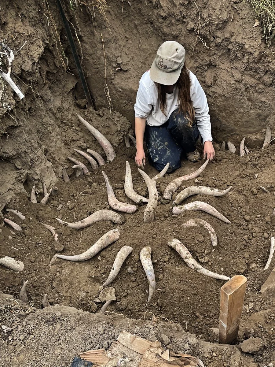
The project will focus on vegetative establishment and biological soil enhancement to reinforce water-management gains. Native plants, deep-rooted perennials, and diverse plant communities will be emphasized to increase root density, maintain continuous soil cover, and stimulate soil microbial activity-key drivers of infiltration and moisture retention. The landscape includes a seasonal riparian corridor associated with the Fire Mountain Canal, which influences soil moisture distribution and plant growth. Historical evidence of beaver activity underscores the site's natural capacity to store and cycle water when supported by appropriate land management. Natural-system analogs, including beaver-inspired water-slowing structures, will be incorporated where appropriate.
Demonstration Management Areas
Four primary demonstration areas will showcase soil health and water-optimizing practices across different land uses: annual kitchen garden permanent beds, diverse crop rotations, heavy organic mulching, and continuous living roots to demonstrate water-efficient food production.
Perennial Food Forest System
A multi-layered system of fruit trees, shrubs, vines, and understory species that stabilizes soil moisture, supports pollinators, and reduces long-term irrigation needs. A native forest and rangeland system already existing on the Terra Firma property. It is a mature landscape area of swales and berms that has been restored with plantings of native grasses, flowers for pollinators, and fruit trees. It is managed to protect soil cover, reduce erosion, and improve infiltration across dryland systems common in the region. High Desert Juniper-Sage landscape unirrigated areas are managed using "slow, spread, and sink" techniques to evaluate soil and water response in typical Western Slope dryland conditions.

Regenerative Management and Animal Integration
All management will follow the six core principles of regenerative agriculture: understanding context, minimizing disturbance, maintaining soil cover, keeping living roots, increasing diversity, and integrating animals where appropriate. Prolific wildlife already contributes to nutrient cycling and soil disturbance, and the project will explore short-duration grazing demonstrations using sheep to further enhance infiltration and soil biological activity.
Water Challenges
The project addresses a fundamental challenge facing the arid southwest, particularly that of the Colorado River Basin (our location is in the Headwaters): degraded soils that cannot effectively capture, store, and cycle increasingly limited and variable water supplies. In compacted or biologically depleted soils, irrigation and precipitation move rapidly across the surface, resulting in runoff, erosion, evaporative loss, and inefficient use of shared water resources. By restoring hydrologic function at the soil and landscape scale, this project seeks to ensure that available water is retained longer in the root zone, used more efficiently by plants, and distributed more equitably across the landscape.
Baseline Assessment
At project initiation, a baseline assessment will document existing conditions across the 7.5-acre site, including: soil texture, structure, and compaction vegetative cover, diversity, and percent ground cover erosion patterns and water movement pathways, initial soil moisture at multiple depths and locations, current irrigation practices, and estimated water inputs.
Metrics for Determining Success
Success will be evaluated using practical, replicable metrics appropriate for producers: Outcomes: Increased soil moisture retention and persistence. Improved infiltration rates. Reduced surface pooling. Reduced runoff, erosion, and sediment movement. Improved irrigation efficiency (equal or improved plant performance with same or less water). Increased vegetative vigor, diversity, and ground cover.
Monitoring Methods: Soil moisture sensors at representative locations. Standardized field infiltration tests. Photo-point documentation after irrigation and storm events. Tracking irrigation frequency and duration. Field assessments of soil aggregation and plant response.
Monitoring will occur seasonally and following major water events, with results used to guide adaptive management.
Knowledge Sharing
Peer-to-peer learning is foundational to the project. The demonstration landscape will function as a regional regenerative learning hub where producers and land stewards learn directly from one another through observation, hands-on participation, and shared interpretation of results.
In The Works
Last season, we recorded numerous regenerative practitioners from the area who were giving farm tours of their operations. These visits have been compiled into a movie depicting the regenerative and water management work that's occurring in the North Fork Valley. The purpose of this video is multi-faceted. It's meant as a fundraiser for continuing this work and also an educational documentary of the many ways caretakers of the land can utilize these practices.
Field Days and Workshops
Seasonal field days and workshops align with key management windows
Spring: baseline conditions, soil health fundamentals, water movement, and ongoing earthwork installation
Summer: soil moisture monitoring, irrigation efficiency, vegetative response, and adaptive management, ongoing earthwork installation
Fall: outcome evaluation, erosion control, perennial establishment, and winter moisture retention, and ongoing earthwork installation. Participants will engage directly in installations, monitoring, and maintenance activities.
Producer Networks and Collaboration
The project will support informal producer networks and collaborate with partners such as the Delta Conservation District, agricultural organizations, and watershed groups. Peer-led tours of neighboring farms will demonstrate how similar principles apply at different scales.
Impact of Local Production
This project will positively impact agricultural producers by providing practical, locally relevant examples of soil health and water-optimizing practices that can be observed, discussed, and adapted within their own operations. In a region where water availability is increasingly constrained and variable, producers need solutions that improve efficiency, resilience, and long-term productivity without requiring prohibitively expensive infrastructure or major operational risk. This project is designed to meet that need. At the local level, producers in Delta County and surrounding Western Slope communities will have access to a working demonstration site that reflects similar climatic conditions, soils, water sources, and management challenges. By seeing regenerative water management and soil health practices implemented on comparable land, producers can better evaluate how strategies such as water-harvesting earthworks, improved soil cover, perennial systems, and biodiversity-based approaches might function within their own context. Hands-on field days, work sessions, and peer-led discussions will allow producers to learn directly from practitioners and from one another, reducing uncertainty and increasing confidence in adoption. The project will also support producers by highlighting how soil health improvements can lead to more effective use of existing irrigation water, reduced erosion and runoff, improved plant performance, and greater drought resilience over time. These outcomes can translate into reduced input costs, more stable yields, and improved land condition, all of which contribute to the long-term viability of agricultural operations. By demonstrating practices that build soil organic matter and water-holding capacity, the project emphasizes solutions that work with natural systems rather than relying on external inputs. Beyond the immediate community, the project will contribute to the larger agricultural community through knowledge sharing, regional collaboration, and peer-to-peer networks. Lessons learned, observed outcomes, and adaptive strategies will be shared through tours, workshops, and informal networks that extend across the Western Slope and beyond. As participants carry this knowledge back to their own operations, the impact of the project will span outward. Additionally, by fostering collaboration between producers, land stewards, restoration professionals, and community members, the project will help strengthen relationships and trust across the agricultural community. This collaborative approach supports collective problem-solving around shared challenges such as water scarcity, soil degradation, and climate variability.
Overall, the project will empower producers with practical tools, locally tested strategies, and supportive peer networks that enable improved soil health and water management. By lowering barriers to adoption and increasing access to hands-on learning, the project contributes to a more resilient, adaptive, and economically viable agricultural community in Delta County and the broader region. This project will provide agricultural producers with practical, locally tested strategies for improving water efficiency through soil health. By observing regenerative practices implemented on land with similar soils, water sources, and constraints, producers can evaluate relevance and feasibility for their own operations. Demonstrated improvements in soil moisture retention, infiltration, and irrigation efficiency will provide tangible evidence that soil health investments reduce risk, improve resilience, and support long-term agricultural viability.
Because practices are modular and low-cost, producers can adopt them incrementally. Beyond the immediate community, lessons learned will be shared through regional networks, extending the project's impact across the Western Slope and contributing to a more resilient, water-efficient agricultural landscape. Through this profound focus on water management and regenerative agriculture, we predict a culture shift within the community where these ideas will become the buzz and farmers will begin approaching these principles with more curiosity and experimentation across the local landscapes. Eventually, this valley will become a hub known for its regenerative activity much the same way as it is known as the most densely populated place for organic farming in Colorado and beyond. When this happens, we will see climactic shifts occur including lower temperatures and more snowpack in winters as the hydrologic system is repaired through our activity. For this to happen, there needs to be a concentration of regenerative practices and water management occurring across the landscape.
Monitoring and Testing Plan
Monitoring and testing are central components of this project and are designed to directly link soil health practices with measurable improvements in water utilization, soil function, and plant performance. Monitoring protocols will prioritize methods that are practical, cost-effective, and replicable for agricultural producers, while also meeting accepted technical standards. The project will combine field-based measurements with laboratory analysis to ensure results are both credible and broadly applicable. Baseline Assessment At the outset of the project, a comprehensive baseline site conditions assessment will be conducted across the contiguous 7.5-acre demonstration landscape. This assessment will document existing soil, vegetation, and hydrologic conditions prior to implementation and will serve as the reference point for all follow-up monitoring. Baseline metrics will include: Soil physical properties: Soil texture, structure, and compaction will be assessed through field evaluations using a soil penetrometer to quantify baseline compaction and rooting resistance across representative areas. Soil chemical and biological indicators: Baseline soil samples will be collected and submitted to the Colorado State University Soil Testing Laboratory for standardized analysis (S1, S3, S11, S15, S17, S19, S20, and S21 test packages). These analyses will establish baseline nutrient status, organic matter, salinity, and soil health indicators.
Vegetative Cover and Diversity
Existing plant cover, species composition, and percent ground cover will be documented through field surveys and photographic records. Hydrologic function and erosion indicators: Visible erosion patterns, runoff pathways, surface pooling, and water movement will be mapped and photographed. Soil moisture and irrigation context: Initial soil moisture conditions and current irrigation practices-including seasonal water deliveries from the Terror Creek Ditch-will be documented to establish baseline water inputs and distribution patterns. This baseline will be developed with support from local partners where appropriate and will provide a clear "before" condition against which project outcomes can be measured.


Ongoing Monitoring and Testing
Following implementation of soil health practices, water-harvesting earthworks, and reseeding, monitoring will occur seasonally and following major irrigation or precipitation events.
Key metrics will include:
Soil infiltration and water intake: A Turf-Tec infiltrometer set will be used to conduct standardized infiltration tests at fixed monitoring locations. Repeat measurements over time will quantify changes in infiltration rates and water intake capacity, providing direct evidence of improved soil structure and hydrologic function.
Soil compaction: The soil penetrometer will be used seasonally to track changes in compaction and resistance at multiple depths, allowing comparison of pre- and post-implementation conditions and evaluation of root-zone improvement.
Soil health laboratory testing: Follow-up soil samples will be submitted to the CSU Soil Testing Laboratory using the same test packages as the baseline. Repeated testing will track changes in soil organic matter, nutrient cycling, salinity, and other soil health indicators over the project period.
Vegetative response and forage quality: Plant vigor, survival, diversity, and establishment success will be monitored across annual, perennial, and native plantings. Forage samples will be collected and analyzed through CSU laboratory forage test packages (P1, P3, and P4) to assess productivity, nutrient value, and overall plant response to improve runoff concentration, particularly in areas influenced by earthworks and water-harvesting features.
Irrigation response: Irrigation timing, frequency, and duration will be tracked to determine whether improved soil function allows for equal or improved plant performance with the same or reduced water inputs. Follow-Up Testing and Adaptive Management Baseline data will be compared with seasonal and end-of-project measurements to evaluate trends in soil health, infiltration capacity, compaction, vegetation performance, and water-use efficiency.
Monitoring results will be reviewed regularly to inform adaptive management decisions, including adjustments to earthworks, reseeding strategies, mulch application, planting density, or irrigation timing. The Terror Creek Ditch will be treated as an important hydrologic context for monitoring, allowing the project to evaluate how soil health practices influence water distribution and retention across a landscape connected to shared irrigation infrastructure.
Observations of wildlife activity, short-duration livestock impact demonstrations, and natural system analogs (such as beaver-inspired water-slowing features) will also be incorporated into qualitative assessments of nutrient cycling, infiltration, and soil disturbance. Documentation, Learning, and Replicability All monitoring results will be documented through field notes, photographs, laboratory reports, and data summaries that are easily interpreted by producers.
These findings will be shared during field days, workshops, and peer-learning events so participants can directly observe how soil health practices influence water behavior, soil function, and plant performance over time. By combining standardized laboratory testing with hands-on field measurements using accessible tools, this project will demonstrate how regenerative soil health practices measurably improve infiltration, soil moisture retention, forage productivity, and drought resilience. The monitoring framework is designed to be scalable and transferable, providing a practical template that other producers can adapt regardless of operation size.